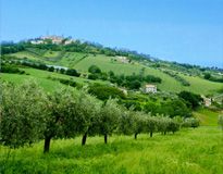
Departing from Teramo you cross the Piceno Aprutina, in direction of Ascoli Piceno. Later around 8 km you reach Campli and the plain of Campovalano where there is the prehistoric necropolis of Campovalano. Continuing toward Fortezza di Civitella, you pass to few hundred meters from the imposing borbonic Fortitude of Civitella del Tronto. Arrived to Piano Risteccio leave the Piceno Aprutina and climb toward San Giacomo (1105m), that is a skiing place situaded between Abruzzo and Marche. We recommend you to visit caciare, an ancient stone huts used by shepherds as a cheeses deposit.
From San Giacomo, you take a steep descent that conducts, before, to San Vito and, after having coasted the artificial lake of Talvacchia, hands in Castellana whose territory is almost entirely inclusive in the National Park of Gran Sasso and Monti della Laga .
Here you can chose whether to continue toward Pascellata and Paranesi, through a briefer itinerary and with smaller gradient, or to go toward Ceppo(1334 ms), well known for his dainty porcini mushrooms.
You reach Ceppo crossing a road that coasts woods of chestnut trees.
From Ceppo you can come back to Teramo crossing a long panoramic descent.
N.B: we recommend you to cross the itinerary in counterclockwise sense and to have available a very short relationship to succeed in overcoming the steep slope among Piano Risteccio and San Giacomo and some lines among Valle Castellana and Morrice.
The principal stages of this itinerary are: Teramo, La Traversa, Campovalano, Rocche di Civitella, Piano Risteccio, Ripe di Civitella, San Giacomo, San Vito, Cesano, Vignatico, Valle Castellana (from here you can cut the run going up to Pascellata and lead to Paranesi), Morrice, Pietralta, Ceppo, Paranesi, Rocca Imposta (also called Rocca Santa Maria), Cona Faiete, Santo Stefano, Torricella Sicura, Teramo.
*we always recommend you the use of a helmet and to bring proper attire for the season, a kit for perforations and for first aid.*
 en
en 


